Generating Geo Shapes
To visualize field force territories without acquiring third-party shape data, users can generate geographical shapes based on existing Address record coordinates. This feature utilizes an algorithm to create boundaries around addresses sharing specific identifiers, ensuring accurate territory mapping, and reducing external data dependencies.
This feature only supports generating Geo Shapes for Veeva-provided vcountry__v records.
Who can use this feature?
- Align Operational Users – Browser
- Generating Shapes for a Country
- Viewing Generated Geo Shapes
- Users require an Align License
Configuring Generating Geo Shapes for
To configure this feature:
- Ensure Configuring Align is complete.
- Navigate to Admin > Users & Groups > Permission Sets.
- Select the appropriate permission set.
- Select the Objects tab.
-
Grant the following permissions:
Object
Object Permission
Object Types
Fields
Field Permission
vcountry__v
RE
All
shape_identifier__v
Edit
- Navigate to Admin > Configuration > Objects > vcountry__v > Layouts.
- Place the shape_identifier__v field on the appropriate layouts.
Address Record Requirements when Generating Geo Shapes
The algorithm used by the Geo Shape Generator derives shapes based on address__v records within the country. For shapes to be generated effectively, ensure these records meet the following prerequisites:
- The vcountry__v field must be populated
- Either the brick__v or postal_code__v field must be populated, depending on the type of geographies assigned to the country’s territories
- The latitude_cda__v and longitude_cda__v fields must be populated. More precise values in these fields result in higher quality generated Geo Shapes
If the generated Geo Shapes are not useful, users can also erase the generated shapes.
Generating Shapes for a Country as
To generate Geo Shapes for a country:
- Navigate to the appropriate vcountry__v record.
-
Populate the shape_identifier__v picklist with the appropriate value. Available values are:
- postal_code__v – Generates shapes based on groupings of address by postal code
- brick__v – Generates shapes based on groupings of addresses by bricks
- Select the All Actions menu.
- Select Generate Geo Shapes.
Users are prevented from generating postal code Geo Shapes against countries where postal code Geo Shapes are already provided by Veeva, for example, the United States.
Erasing Shapes for a Country
Users can also erase generated Geo Shapes:
- Navigate to the appropriate vcountry__v record.
- Ensure the shape_identifier__v field is populated correctly.
- Select the Gear button.
- Select Erase Geo Shapes.
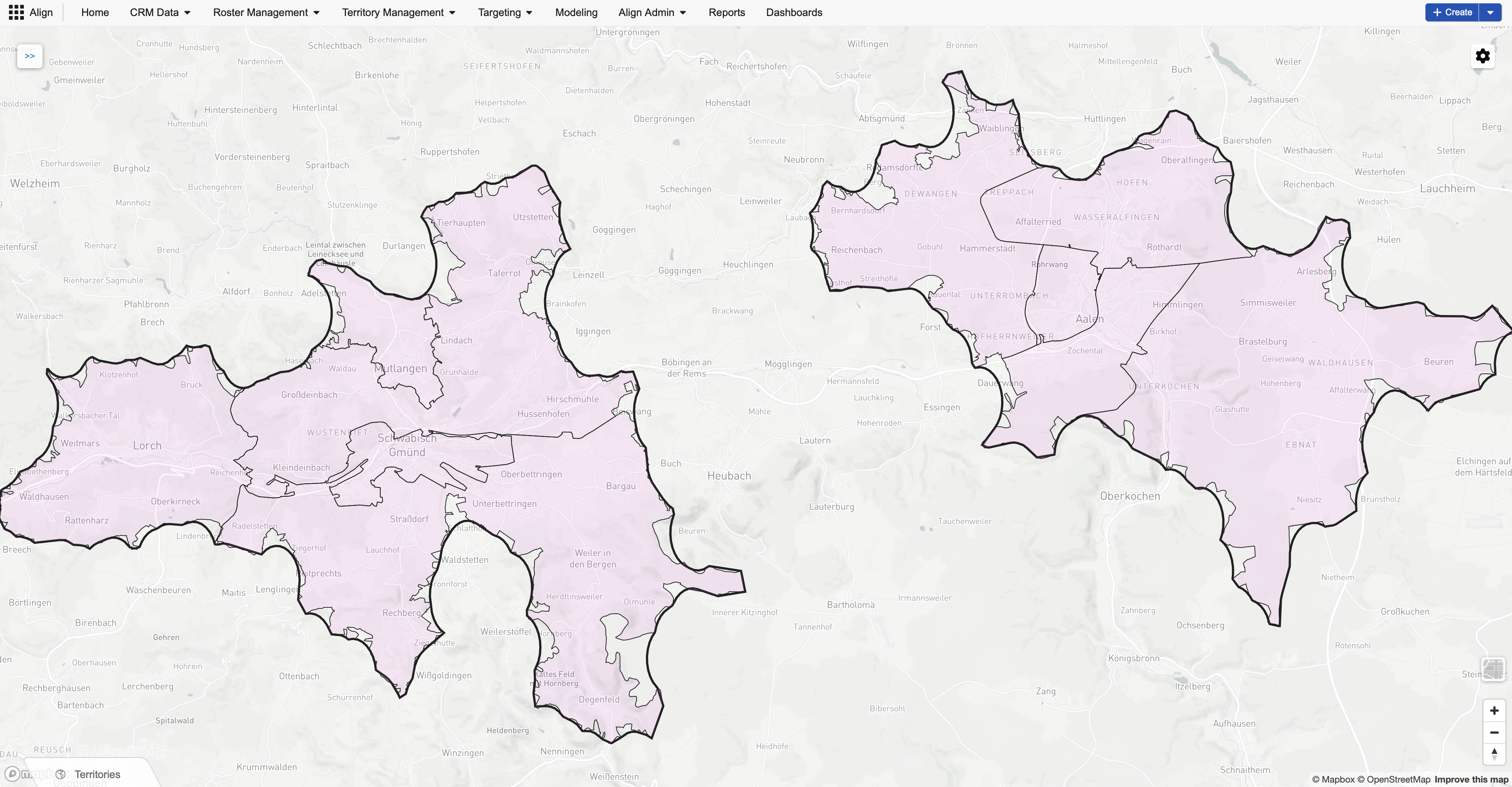
Viewing Generated Geo Shapes as
Once the generation process is complete, navigating to any aln_territory__v or aln_model_territory__v record within the selected country displays the territory’s shape in the Map section. Selecting the map displays a more detailed view of the territory with outlines of each geography comprising the territory.